Thursday April 2026
হটলাইন
কনটেন্টটি শেষ হাল-নাগাদ করা হয়েছে: মঙ্গলবার, ২ জানুয়ারী, ২০২৪ এ ০৪:১৮ PM
এক নজরে
কন্টেন্ট: পাতা
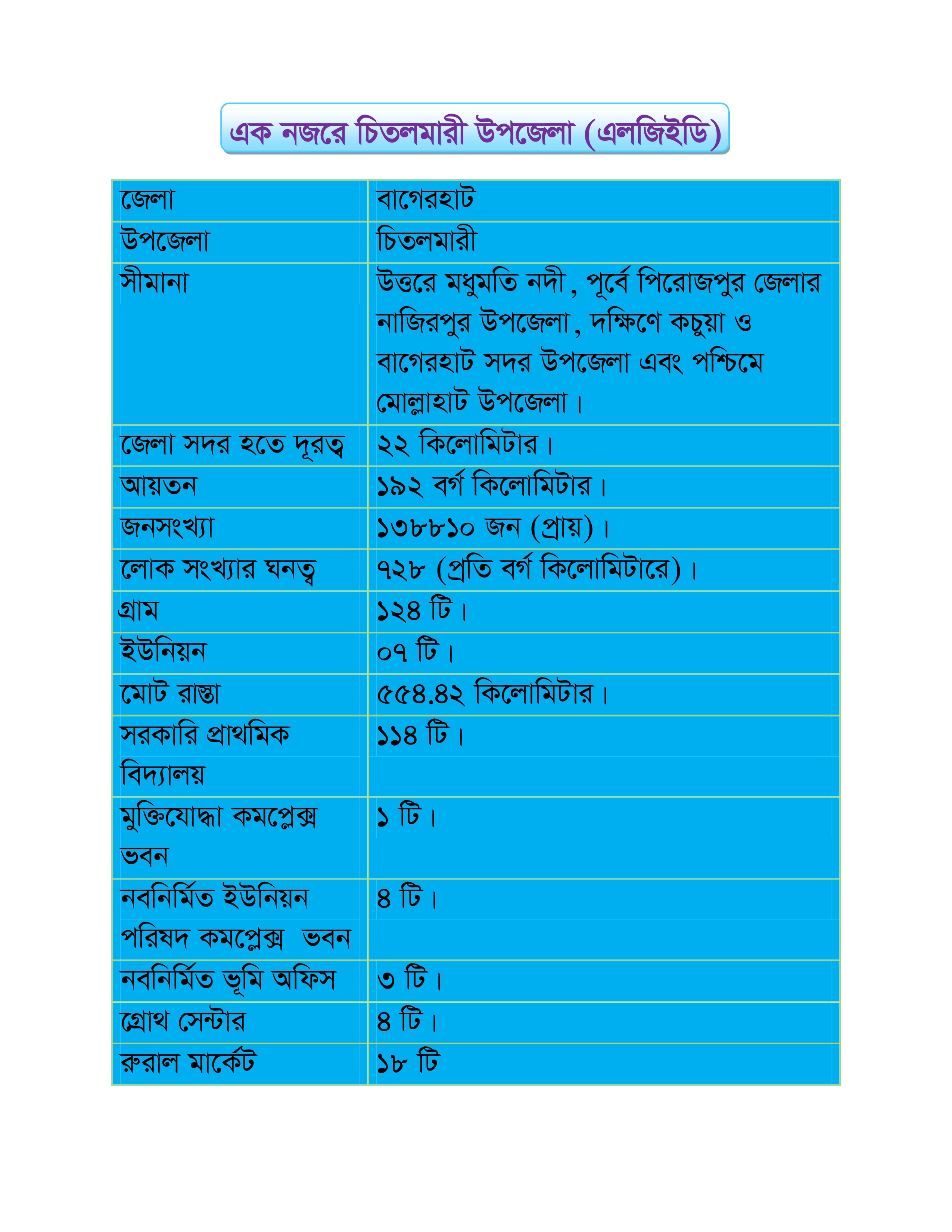
| District | Bagerhat. | |
| Upazila |
| |
| Boundaries | Madhumati river on the north, Nazirpur upazila of Pirojpur district on the east, Kachua and Bagerhat Sadar upazilas on the south and Mollahat upazila on the west. | |
| Distance from district headquarters | 22 km. | |
| Volume | 192 sq km. | |
| Population | 138810 (approximately). | |
| Density of population | 728 (per sq km). | |
| Village | 124. | |
| Union | 07. | |
| Total road | 554.42 km. |
| Govt. primary school | 114. |
| Liberation War complex building | 01. |
| New established Union Porisod complex building | 04 |
| New established land office | 03. |
| Growth center | 04. |
| Rural market | 18. |